

Atmospheric Correction Software for Airborne and Satellite Imaging
Physical surface properties retrieval for optical and thermal remote sensing systems, coming in two versions
– ATCOR®-S for sensors in space,
– ATCOR®-A for systems on aircraft carriers
Interested?
Introducing ATCOR
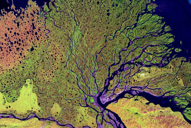
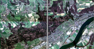
ATCOR® can be used for a broad variety of supported satellite and airborne sensor systems to retrieve physical parameters of the earth’s surface, i.e. surface spectral reflectance, emissivity and temperature. It uses a physical inversion process to retrieve consistent quantitative information. The version ATCOR-S is used for satellite sensors and ATCOR-A for airborne systems. All ATCOR versions support multispectral, hyperspectral as well as thermal infrared remote sensing data. ATCOR includes models for reflectance retrieval in rugged terrain, under the precense of clouds in shaded areas and for oblique observation angles.
The ATCOR® software product is developed and maintained by ReSe Applications LLC while the ATCOR® brand is held by DLR (German Aerospace Agency).
Note: The product “ATCOR® Workflow for IMAGINE” is an integrated version of ReSe’s ATCOR-S and is distributed exclusively by GEOSYSTEMS GmbH.
Ask for our free trial version.
Features

Physical surface reflectance retrieval method

Radiation parameters from MODTRAN® radiative transfer model

Temperature and emissivity retrieval for TIR sensors

Aerosol optical thickness estimate by enhanced dark object analysis and dark dense vegetation methods

Topographic illumination correction based on digital surface model

Image-based cirrus and haze removal

Optional inflight radiometric calibration

Built-in standard vegetation products and unsupervised classification

Data visualization, evaluation and basic processing using the built-in GLIMPS tools

De-shadowing of cloud and building shadow areas using image-based routines

Batch processing and mosaicking support

Spectral recalibration for VNIR and SWIR using oxygen band positions
Model based BRDF correction (BREFCOR)
Value added products, e.g. LAI, Albedo, or heat flux
About ATCOR®
During the last decades, space-and airborne sensors have been widely used in different fields such as agriculture, meteorology, Earth sciences, geology, or exploration. Image acquisition is possible for clear and cloudy conditions and in areas difficult to access. Data acquisitions, however, are almost always conducted under conditions which require to thoroughly account for sensor calibration, atmospheric and illumination effects prior to a meaningful retrieval of geo-physical parameters such as surface spectral reflectance*, emissivity and temperature. Our physical approach of atmospheric correction software provides a practical solution to this problem. It improves the analysis of series of images since ground brightness variations caused by varying illumination conditions and atmospheric influences can be compensated.

Advantages of ATCOR®
- Usable without expert knowledge about atmospheric compensation
- Reflectance retrieval consistent over time and solar position
- Enables meaningful time series analyses through coherent reflectance and temperature retrievals
- Allows quantitative index analysis using absolute reflectances
- Supports a wide range of different sensors:
- Spaceborne: Landsat, SPOT, ASTER, Worldview, Pleiades, Planet-Scope, EnMAP, EMIT, PRISMA, Gaofen, Ikonos, Quickbird, RapidEye, VENuS, Sentinel, and many more
- Airborne: AVIRIS, Itres CASI, Specim AISA, NEO Hyspex/Mjolnir, Headwall Hyperspec, Resonon Pika, HyMap, and many more
- Easy definition and addition of new sensors
How ATCOR® Compares
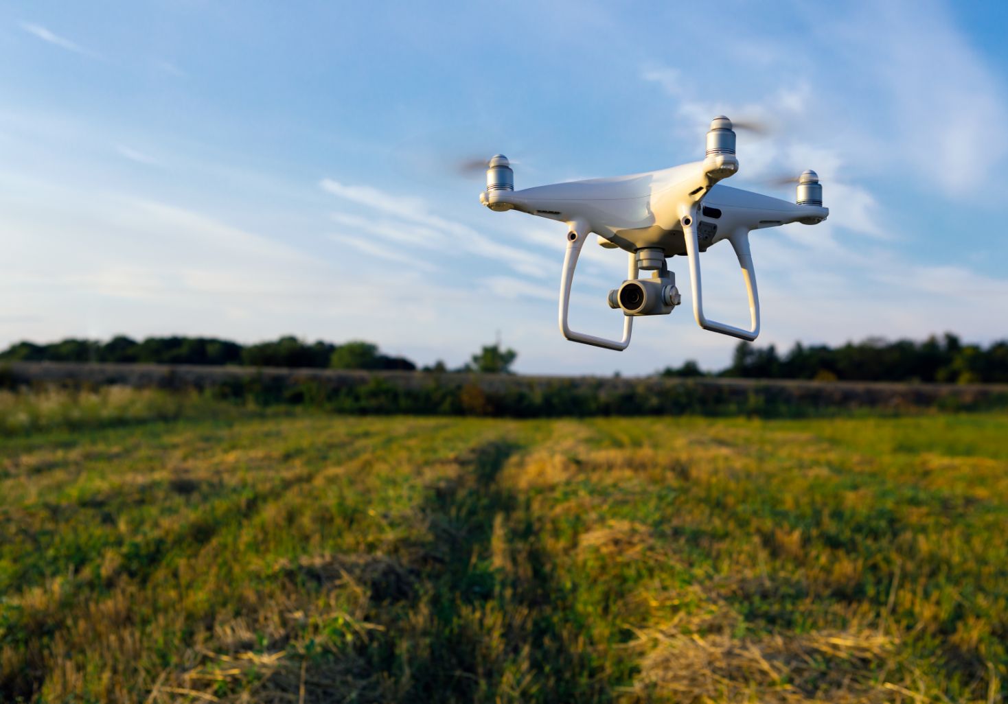
ATCOR® is optimized for satellites and higher flight altitudes (i.e. > 2 km above ground). For lower flight altitudes, like typical for drones, DROACOR® can be used.
In comparison to similar software tools (e.g. FLAASH) for atmospheric compensation ATCOR® offers:
- Terrain topographic and illumination correction
- Haze-, cirrus-, and shadow-removal
- Batch processing
- Spectral and radiometric calibration
- model based BRDF correction (BREFCOR)
Use Cases
Prices
ATCOR® Education
from EUR 1’000.- / yearGet a free evaluation license to try out this new software application at no cost for 20 days. A trial version may be issued once per person upon request. It contains all the functionality of the regular version.
ATCOR® Research
from EUR 1’600.- / yearGet a free evaluation license to try out this new software application at no cost for 20 days. A trial version may be issued once per person upon request. It contains all the functionality of the regular version.
ATCOR® Commercial
from EUR 2’350.- / yearGet a free evaluation license to try out this new software application at no cost for 20 days. A trial version may be issued once per person upon request. It contains all the functionality of the regular version.
Testimonials
About Us
ReSe Applications LLC provides Remote Sensing Software Applications for processing of multispectral, hyperspectral and thermal IR images. The provided software applications PARGE®, DROACOR®, ATCOR® and MODO are designed to analyze and process remote sensing data derived from operational satellite systems as well as airborne and UAV devices. Supported airborne and drone systems are AVIRIS, HAIP BlackBird V2, Headwall Hyperspec Nano, Hyamap, Itres’ CASI/SASI, NEO’s HySpex Mjolnir, Resonon Pika, Specim AISA/AFX, and more. Our software builds upon IDL technology to extend remote sensing software packages like ENVI.
News
ATCOR®-4 version 7.5 is released!
ATCOR®-3 version 9.5 is released!

New website for ATCOR® launched.


